

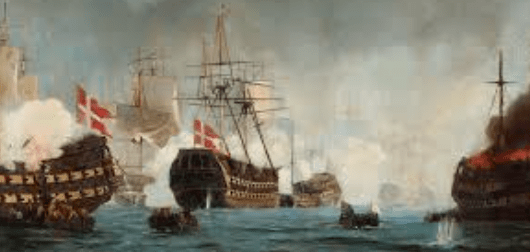
Victory that was owed to the cumbersomely named Hydrographical Office, the Royal Navy Department responsible for its charts, detailed maps of seas and coasts, with tidal ranges, water depths and other essential relevant details, after the battle of Copenhagen, in 1801, confronted by a formidable fixed line of Danish ships supported from the land, Admiral Horatio Nelson had to make a bold decision . Should he risk taking his ships into the narrow, shallow channel where the enemy lay, so that Nelson’s three ships ran aground before the battle had properly begun? Admiral Parker, the commander of the British fleet, signalled to withdraw. Notoriously, Nelson put his telescope to his blind eye, declared he could see no such signal and pressed on to victory. The Hydrography gave Nelson the confidence to sail into the channel, helped by Alexander Briarly, the master of HMS Bellona, and a keen hydrographer, who volunteered to lead the fleet in. Ironically the Bellona was one of the ships that ran aground, but by then Briary’s job was done. Nelson commended him afterwards for his work and thinking “sounding and taking marks”.
Sailing was also very tricky during the conflict with France between 1792 and 1815, Britain lost more than twice as many warships to shipwreck than to enemy action. While the French had established the Depot des Cartes, Plans of Journaux de la Marine in 1720, the British did not get round to it until 1795 when Alexander Dalrymple was appointed hydrographer to the Board of the Admiralty. It Is here captain Michael Barritt RN, himself a former hydrographer of the navy, begins his story.
Dairymple and his successor form 1808, Thomas Hurd were simply charged with looking after the Admiralty’s hand-drawn charts and having them printed for distribution around the fleet. As the war went on, they expanded on their remit to commission surveys, identify suitably talented personnel to carry them out and issue specialist equipment such as theodolites and chronometers, Before Hurd established an official system of supplying charts to the fleet, captains had been responsible for gathering their own, from whatever sources they could muster. Barritt wanted arranged by place from the Caribbean to the East Indies, from the Mediterranean to the Baltic, as he shows how the Royal Navy put the world’s oceans on paper. Such an approach does not make for a straightforward narrative, though, and entails a lot of jumping about – Trinidad in 1808, back to Egypt in 1798, forward to Naples in 1814, back to Denmark in 1801. Barritt knew the importance of navigation in the Copenhagen attack because he had been at the Battle of the Nile in 1798 where Nelson had also surprised the enemy by sailing a tight channel, and key ship, the Culloden, had run aground. Briarly made his own charts of the battle and the blockage of Malta, which, at Nelson’s urging he published commercially in 1800 rather than offer to the Hydrographical Office, much to its annoyance.
Audacioys Briarly became a Trinidad slave owner and lieutenant colonel in the militia, but by 1805 was back at sea fighting privateers and charting coastal Venezuela. While he was suspected of connivance in smuggling, it was his excessive expense claims that ultimately ended his Royal Navy career. He reinvented himself as a wool merchant in Cadiz and in 1809 organised the transport of 1000 sheep to George III, At the request of the British, he entered the Spanish Navy as a captain de frigate and adjutant to an admiral. He ended up as a naval commander in Mallorca.
Nelson’s Pathfinders is the most compelling account of British sea power, especially in the conflict with Napoleon and definitely enhances our understanding of the basis on which it was achieved.
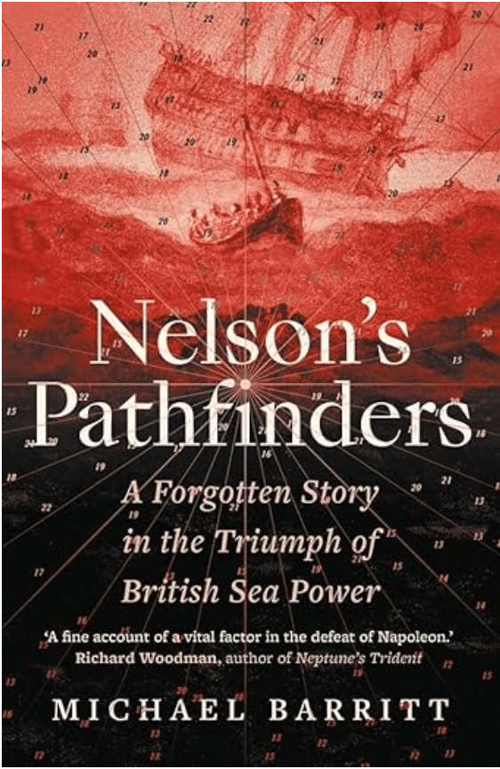
Nelson’s Pathfinders: A Forgotten Story in the Triumph of British Sea Power by Michael Barritt, Yale £25, 288 pages.

I think there is a misunderstanding about who wins battles and WHO the battlers support? I support those who feel discriminated against or undermined but stop at supporting those who choose a life of leisure on benefits whilst aiming agression against the hard working, studying and fun seeking which is a MUST to those who live in London to show that you patronise and LOVE the city you inhabit. I put my faith in the lord that with prayers the lord – who supervises any and all faiths will see FAIR PLAY. If you want to pursue this theme look into the SEVEN DEADLY SINS…..these can vary according to what book or website you choose to research. Sloth Gluttony Envy and Lust are four of them. Peace. Aymen.
LikeLike